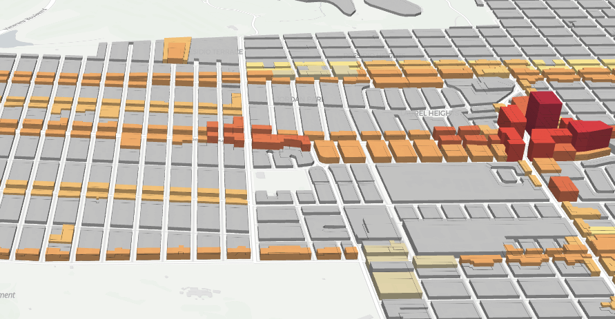
SF Family Zoning Plan 3D Map
Interactive 3D visualization of proposed building heights under San Francisco's new upzoning plan.
Interactive maps, visualizations, and analyses accompanying FoglineSF articles on San Francisco zoning, housing, transit, and civic data.
Interactive 3D visualization of proposed building heights under San Francisco's new upzoning plan.
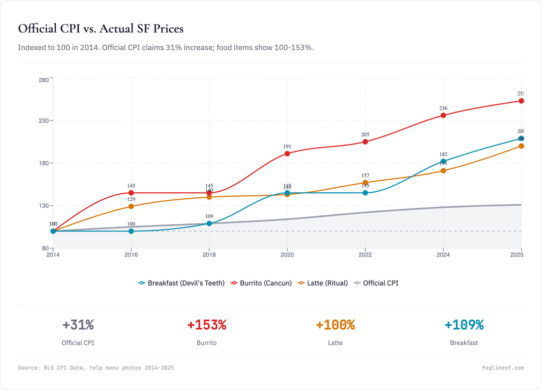
A look at why San Francisco's everyday prices feel like they've risen faster than the official 2.5% inflation figure suggests.

A case for the 33 as Muni's most versatile route, and the neighborhoods it threads together across the city.